

WE all know just how dangerous the roads in Herefordshire can be.
And now you can find out where the most dangerous roads near you are using an interactive map from Crashmap.co.uk.
Crash Maps has recently updated its site and now includes information about where crashes took place in 2020.
The app uses official data from The Department of Transport, which it then inputs onto an interactive map.
It shows you where ‘fatal’, ‘serious’ and ‘slight’ driving accidents took place in your area, and includes the number of vehicles, and casualties involved.
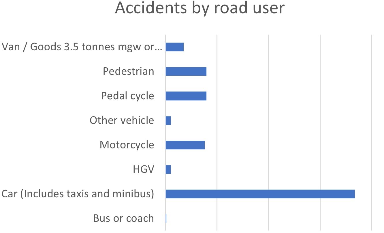
Cars were most likely to be involved in crashes in Herefordshire
According to the interactive map, hundreds of crashes took place on Herefordshire's roads last year.
However, some roads are more dangerous than others with multiple crashes taking place on them.
According to Crash Maps, the most fatal accidents took place on the A49 in Herefordshire, with eight recorded between 2015 and 2020, but further fatal and non-fatal crashes took place on both main and smaller, rural roads across the county.
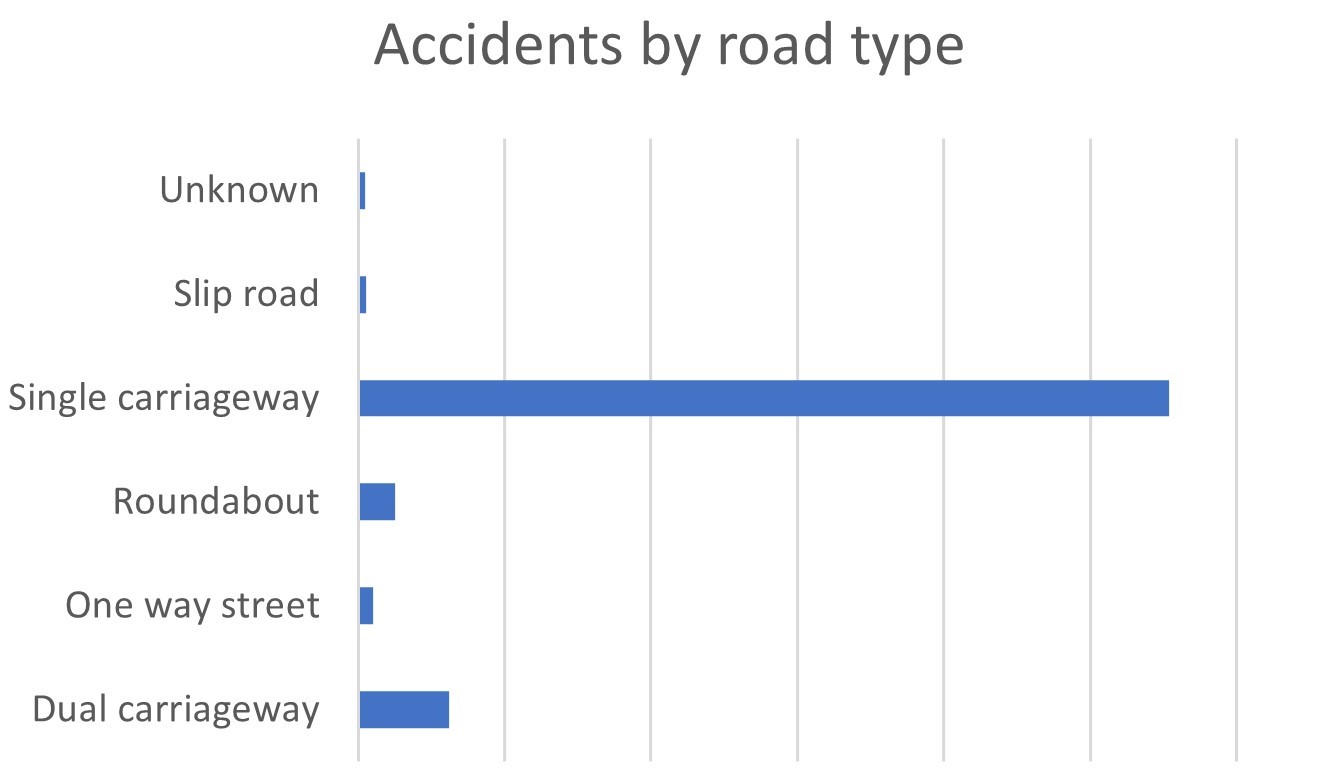
The vast majority of accidents were recorded on single carriageways, according to government data
Large clusters of accidents were also recorded in Hereford and the county towns, although these are largely recorded as 'slight'.
Want to find out where car accidents have take place near you? Click here to visit the interactive map for yourself.


Comments: Our rules
We want our comments to be a lively and valuable part of our community - a place where readers can debate and engage with the most important local issues. The ability to comment on our stories is a privilege, not a right, however, and that privilege may be withdrawn if it is abused or misused.
Please report any comments that break our rules.
Read the rules hereLast Updated:
Report this comment Cancel