
AFTER the First World War, work was scarce for the men of Talgarth, Glasbury and Hay; so some jumped at the chance of a job on the construction of the Grwyne Fawr Reservoir.
Between home and the works loomed the towering summit of Y Das in the imposing northern escarpment of The Black Mountains.
There was a 20-strong contingent of workers from Talgarth and a few lodged at Blaen-y-cwm village near the dam during the week.
But because this meant extra expense, the others elected to make the journey there and back every day, performing almost incredible feats of endurance.
Employees Bridewell, Speak, Lloyd and Davies were among the indomitable navvies who left home at 4am for the day shift.
They had bikes which they would ride and push two miles and about 200 metres up to the foot of Y Das Mountain and leave them there. Next came the punishing mile-and-a-bit 300-metre climb up Rhiw Constabl (the constable’s steep ascent). Then, a twomile rocky mountain trek to the quarry.
The 9d an hour shift ended at 5.30pm, to be followed by a two-hour tramp home, though the last couple of miles could be freewheeled downhill on the waiting bike.
Mist, rain and blizzards sometimes made the journey hazardous and it was easy to get caught on the mountain ridge, the conditions making it impossible to descend to Talgarth or get back to the works.
On one occasion two of the men had to spend the whole night on the mountain and nearly lost their lives. In winter time, good protective clothing was essential for survival.
They wore thigh high wellingtons with Welsh wool socks, a waterproof mackintosh and cap.
Today, we can get a sense of the arduous “commute”
of 1920 by taking a contouring route up from Talgarth to the Wern Frank Wood area where the Talgarth men would leave their bikes after taking a more direct route up to the foot of the mountain.
We can take a gentle climb up two commons under the hawkeye of the graceful red kite which had vanished in their day. At point five on our route we have the option to go “over the top”
for a view of the dam in the Grwyne Fawr Valley.
Thankfully the subsequent pick-wielding ten hour shift is no longer necessary.
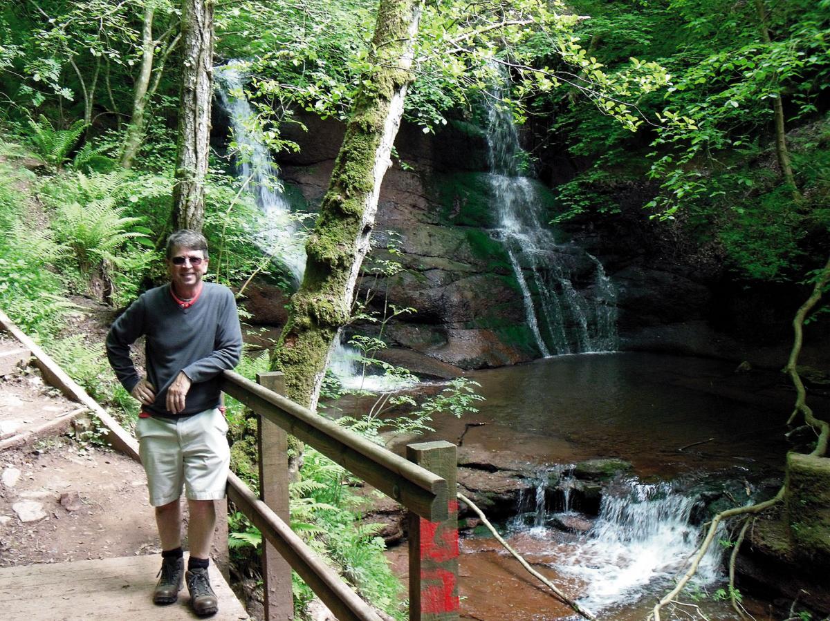
On the way back down to Talgarth, the Pwll-y-Wrach Falls, or Witches Pool, is in a Nature Reserve offering the chance of a shower in the spray. Here you are in the dappled shade of ancient oak, ash and alder woodland occupying 17 hectares along the River Enig.
The birdlife includes redstart, chiffchaff, pied flycatcher, dipper and grey wagtail.
The hallmark of a beautiful summer ramble over largely good terrain is its variety.
The stretch along the foothills above Talgarth and beneath their vertical route, duly inscribed with initials at the S-bend half way up, gives a great perspective of the navvies’ endeavours.
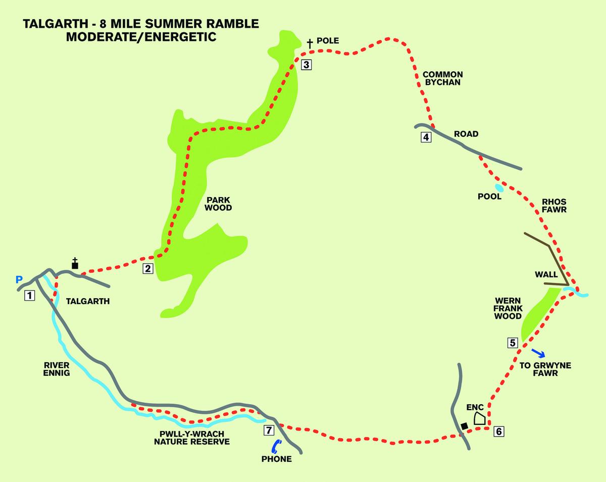
THE ROUTE 1. Station Road Free Park, Talgarth. Exit via south, vehicle entrance. TL to town and TR along Bell Street.
Keep ahead and cross brook via bridge, TL along footpath, cross f/bridge in front of Brookside and carry on up walled lane.TR and keep R beyond church and graveyard.
At fork go L past 3 bungalows through gate ahead and gate on L. Go up R edge of field over two stiles into meadow. Climb steeply, very slightly left.
2. Park Wood. Cross stile into wood and bear L up path, winding to broad forest path. Now TL to follow broad path ahead for fully 1½ miles. Just under half way, veer R and at a broad fork, take the upper (R) option. Pass three marker posts, drop and rise gently to cross stile out of wood into meadow.
3. Go ahead to Telegraph Pole. Bear R 75m to pick up a rutted grass farm track and follow it uphill and slightly L. Go through gate along lane/stony path ahead and bridle gate just beyond a house drive. Emerge on to Common Bychan and fork R uphill immediately. Keep to R edge, bending R along springy moorland path. Go SSE half a mile all the way up to a surfaced lane ahead.
4. Lane. TL along lane through gate. About 60m beyond point where trees stop lining both sides of the lane, at a marker post, go half right on to Rhos Fawr Common in the general direction of a stone wall.
Pass just L of pool, SE, to the highest point of this common. You should now be able to see a stone gulley and stream ahead R. Drop down to it. Ford stream in gulley and take R path out of it. Follow path just above Wern Frank Wood across a little gulley, through bridle gate by stile.
5. (Option to go L here, up the fence and “over the top”
of Y Das, two miles arduously but spectacularly there and back for distant view of Grwyne Fawr Reservoir).
Now – careful. Continue ahead along path by R fence (not on OS map) over ford through fern and scrub. It’s generally straight ahead SSW, with an early R fork, as if for the isolated mountain (Mynydd Troed). You are heading for the L end of a fenced pasture ahead of you.
6. Fenced pasture enclosure.
Walk ahead beyond this L corner 50 paces to a stile just past a gate, and in front of a gulley. TR over stile. Follow green path with brook L and fence R. Now go one mile due west: past Upper Pen y bryn, across road and over stile (for Pwlly- Wrach): Keep going in the same direction across meadows, pastures and through gaps. Reach gap in crossing line of trees marked by a wooden and stone post. Bear very slightly R down pasture. Find and cross a stile under trees on to road.
7. Road. With telephone box left, TR for 125m and TL over stile. Follow woodland footpath, keeping to L along River Ennig, through k-gate down steps.
Go ahead past waterfalls, bear R at information board along path through k-gate on to road back down to Talgarth.


Comments: Our rules
We want our comments to be a lively and valuable part of our community - a place where readers can debate and engage with the most important local issues. The ability to comment on our stories is a privilege, not a right, however, and that privilege may be withdrawn if it is abused or misused.
Please report any comments that break our rules.
Read the rules hereComments are closed on this article